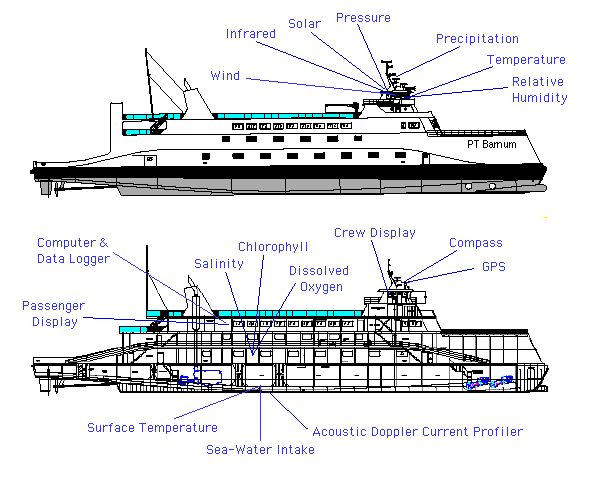
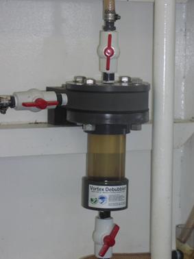
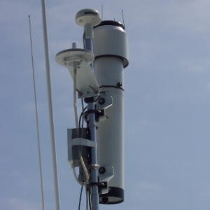
The Water-Air Quality Sensing Project (WASP) is a project that employs water-based platforms and other data gathering techniques to provide real-time and historical monitoring of water and air quality. In one system, the P.T. Barnum ferry of the Port Jefferson Steamboat fleet houses sensors and the computers used to collect and transport the data to the WASP ground station, as shown in the diagram above. The sensors, some of which are shown below, collect routine observations of several significant environmental parameters during the ferry's routine crossings (approximately 10 per day) of the Long Island Sound. At present this system is routinely collecting near-surface atmospheric wind, pressure, temperature, relative humidity, solar and infrared radiation and rainfall, as well as near-surface water temperature and salinity and surface-to-bottom current profiles.
The sensor information is collected and transmitted back to the MSRC in real-time via wireless communication where one-minute average values are archived and made available via ftp/web access. The data is archived at the ground station and made available through a Web interface. The interface allows for the generation and display of images relating to the sensor data and map positional data. The sensor data plots are available for current data as well as historical data. For more information, see the Sound Science Web site.
In the current academic year, we are extending the user interface to include a new style of interaction, referred to as the Ajax model. This model allows the marine science data to be incrementally loaded to the user's browser. For example, when the user selects Port Jefferson on the browser, the map on the page changes, but the remainder of the page does not. This version of the system also incorporates Google Maps, so the user is able to interactively pan and zoom on the map, and in the case of the Plankton system, create displays of the data stations on the map.
For the MSRC component, we plan to expand the WASP prototype to include other environmental sensors relevant to homeland security (e.g., other sources of radiation, atmospheric aerosols, marine toxins, etc) with enhanced forms of data redundancy, access and analysis features.
| Students |
|---|
| 2009-2010 |
|
We are also planning architectural changes to the sensor suite architecture. The current approach is a collection of sensors networked to a server responsible for data collection and transmission to a ground station. We are considering an architecture that would allow an asynchronous collection of sensors in which individual sensors would be responsible for data transmission. This extended architecture would allow buoy mounted sensors integrated into a more robustly deployed collection of sensors.
Two additional aspects related to the project are worth highlighting:
The system is being developed in collaboration with the Stony Brook Marine Sciences Research Center (MSRC), Prof. Robert Wilson.
The Bridgeport - Port Jefferson Steamboat Company has also provided the vessel onto which the sensors have been deployed as well as active cooperation to ensure the accuracy of the sensor data.